Coincident#
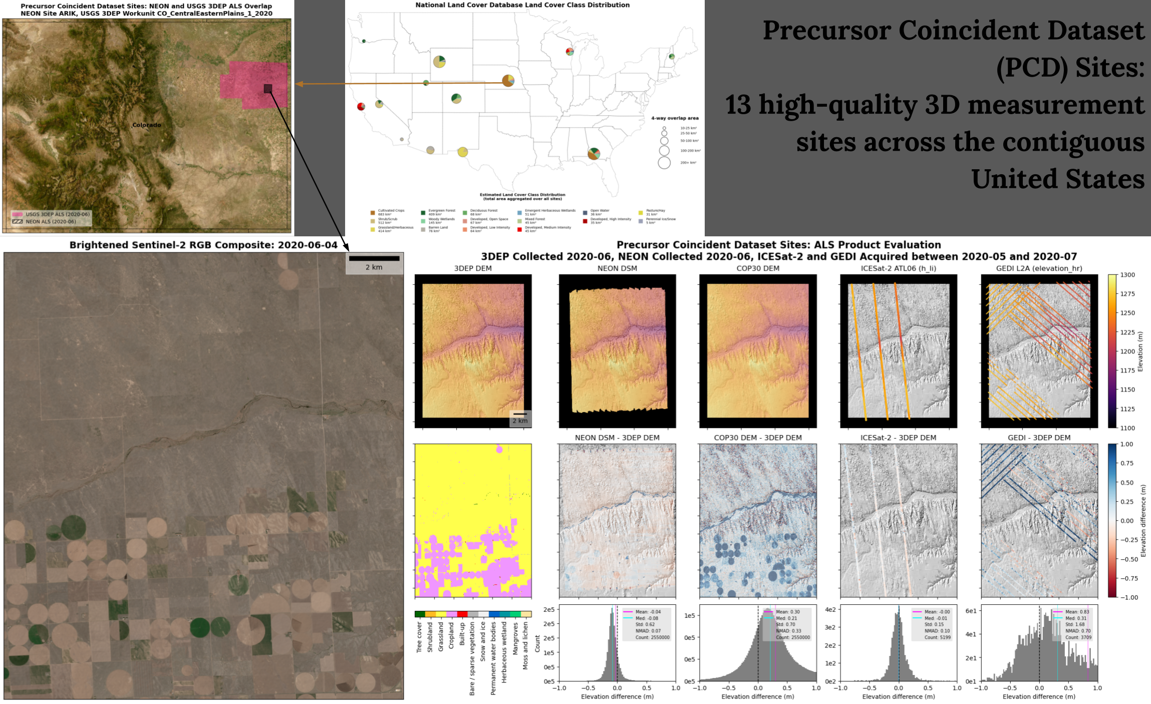
Over the past two decades, large archives of 3D surface elevation measurements have been acquired from a range of airborne and satellite platforms. Many of these datasets are now publicly available from cloud storage, enabling efficient, on-demand search, subsetting, and data access.
This Python package provides functions to conveniently search across different data providers for coincident elevation measurements. It also provides utilities to efficiently load measurements into GeoPandas and Xarray for intercomparison.
Documentation structure#
The documentation is separated into three main sections accessible on the top navigation bar: The User Guide is the best place to get started, Examples showcase Jupyter Notebooks which highlight different datasets and common analysis workflows, and the API Reference documents all available functions. For any given section, subsections appear on the left-hand navigation bar, and for any given subsection page headers appear on the right-hand navigation bar.
See the following website for more details on the motivation for this project! https://science.nasa.gov/earth-science/decadal-surveys/decadal-stv/coincident-datasets