Additional Aerial LiDAR Datasets#
This notebook will highlight the additional aerial LiDAR datasets besides USGS 3dep that are available in the coincident package and how to grab those datasets’ footprints using spatial and temporal search parameters.
Other Supported Catalogs:
NASA G-LiHT
NOAA Coastal LiDAR
NCALM LiDAR
NEON LiDAR
import coincident
import geopandas as gpd
/home/docs/checkouts/readthedocs.org/user_builds/coincident/checkouts/104/src/coincident/io/download.py:27: TqdmExperimentalWarning: Using `tqdm.autonotebook.tqdm` in notebook mode. Use `tqdm.tqdm` instead to force console mode (e.g. in jupyter console)
  from tqdm.autonotebook import tqdm
%matplotlib inline
# %config InlineBackend.figure_format = 'retina'
NASA G-LiHT#
Access the NASA CMR STAC catalog for the NASA G-LiHT project (Goddard LiDAR, Hyperspectral, and Thermal Imager)
aoi = gpd.read_file(
    "https://raw.githubusercontent.com/unitedstates/districts/refs/heads/gh-pages/states/MD/shape.geojson"
)
aoi = aoi.simplify(0.01)
aoi.explore()
gf_gliht = coincident.search.search(
    dataset="gliht",
    intersects=aoi,
    datetime=["2017"],
)
gf_gliht.head()
| assets | bbox | collection | geometry | id | links | stac_extensions | stac_version | type | datetime | end_datetime | start_datetime | storage:schemes | dayofyear | |
|---|---|---|---|---|---|---|---|---|---|---|---|---|---|---|
| 0 | {'001/GLDSMT_SERC_CalTarps_31July2017_am_l0s0/... | {'xmin': -76.5520244, 'ymin': 38.8724263, 'xma... | GLDSMT_001 | POLYGON ((-76.55112 38.87243, -76.54378 38.872... | GLDSMT_SERC_CalTarps_31July2017_am_l0s0 | [{'href': 'https://cmr.earthdata.nasa.gov/stac... | [https://stac-extensions.github.io/storage/v2.... | 1.1.0 | Feature | 2017-07-31 04:00:00+00:00 | 2017-08-01 03:59:59+00:00 | 2017-07-31 04:00:00+00:00 | {'aws': {'bucket': 'lp-prod-protected', 'platf... | 212 |
| 1 | {'001/GLDSMT_SERC_CalTarps_31July2017_am_l2s0/... | {'xmin': -76.5530933, 'ymin': 38.8733421, 'xma... | GLDSMT_001 | POLYGON ((-76.55206 38.87334, -76.54427 38.873... | GLDSMT_SERC_CalTarps_31July2017_am_l2s0 | [{'href': 'https://cmr.earthdata.nasa.gov/stac... | [https://stac-extensions.github.io/storage/v2.... | 1.1.0 | Feature | 2017-07-31 04:00:00+00:00 | 2017-08-01 03:59:59+00:00 | 2017-07-31 04:00:00+00:00 | {'aws': {'bucket': 'lp-prod-protected', 'platf... | 212 |
| 2 | {'001/GLDSMT_SERC_CalTarps_31July2017_am_l8s0/... | {'xmin': -76.5533652, 'ymin': 38.869171, 'xmax... | GLDSMT_001 | POLYGON ((-76.55199 38.86917, -76.5442 38.8692... | GLDSMT_SERC_CalTarps_31July2017_am_l8s0 | [{'href': 'https://cmr.earthdata.nasa.gov/stac... | [https://stac-extensions.github.io/storage/v2.... | 1.1.0 | Feature | 2017-07-31 04:00:00+00:00 | 2017-08-01 03:59:59+00:00 | 2017-07-31 04:00:00+00:00 | {'aws': {'bucket': 'lp-prod-protected', 'platf... | 212 |
| 3 | {'001/GLDSMT_SERC_CalTarps_31July2017_am_l4s0/... | {'xmin': -76.5531537, 'ymin': 38.8686178, 'xma... | GLDSMT_001 | POLYGON ((-76.55157 38.86862, -76.54333 38.868... | GLDSMT_SERC_CalTarps_31July2017_am_l4s0 | [{'href': 'https://cmr.earthdata.nasa.gov/stac... | [https://stac-extensions.github.io/storage/v2.... | 1.1.0 | Feature | 2017-07-31 04:00:00+00:00 | 2017-08-01 03:59:59+00:00 | 2017-07-31 04:00:00+00:00 | {'aws': {'bucket': 'lp-prod-protected', 'platf... | 212 |
| 4 | {'001/GLDSMT_SERC_CalTarps_31July2017_am_l6s0/... | {'xmin': -76.5534253, 'ymin': 38.8695516, 'xma... | GLDSMT_001 | POLYGON ((-76.55182 38.86955, -76.54119 38.869... | GLDSMT_SERC_CalTarps_31July2017_am_l6s0 | [{'href': 'https://cmr.earthdata.nasa.gov/stac... | [https://stac-extensions.github.io/storage/v2.... | 1.1.0 | Feature | 2017-07-31 04:00:00+00:00 | 2017-08-01 03:59:59+00:00 | 2017-07-31 04:00:00+00:00 | {'aws': {'bucket': 'lp-prod-protected', 'platf... | 212 |
gf_gliht.explore(column="id")
Note that the The search coincident searches the NASA G-LiHT ‘GLDSMT_001’ STAC catalog by default, which is a tiled DSM product. There are many other G-LiHT products available to search as seen below. That being said, not all G-LiHT flights will have all of the below products available.
Here’s a quick look at all of the available G-LiHT STAC collections (for CHM, DSM, DTM, Radiance, etc. products):
import pystac_client
stac = pystac_client.Client.open('https://cmr.earthdata.nasa.gov/stac/LPCLOUD')
cols = list(stac.get_all_collections())
[c.id for c in cols if c.id.startswith('GL')]
['GLORTHO_001',
'GLCHMK_001',
'GLCHMT_001',
'GLDSMT_001',
'GLDTMK_001',
'GLDTMT_001',
'GLHYANC_001',
'GLRADS_001',
'GLREFL_001',
'GLHYVI_001',
'GLLIDARPC_001',
'GLMETRICS_001',
'GLTRAJECTORY_001',
'GLanCE30_001']If you want to search any of these additional collections, just run:
gliht_custom = coincident.datasets.nasa.GLiHT(collections=['GLLIDARPC_001'])
gf = coincident.search.search(
    dataset=gliht_custom,
    ...
)
OpenTopography API#
coincident supports the use of the OpenTopo /otCatalog API to access additional aerial LiDAR data.
opentopo datasets currently supported includes the NOAA Coastal LiDAR Catalog and NCALM Aerial LiDAR Catalog.
Note
The NCALM Aerial LiDAR Catalog also includes user-submitted flights
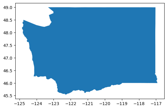
# first, we'll search for NOAA Coastal LiDAR missions in Washington
# we'll inspect 2018 arbitrarily
aoi = gpd.read_file(
    "https://raw.githubusercontent.com/unitedstates/districts/refs/heads/gh-pages/states/WA/shape.geojson"
)
date = "2018"
aoi.plot();
gf_noaa = coincident.search.search(dataset="noaa", intersects=aoi, datetime=[date])
gf_noaa
| id | name | title | start_datetime | end_datetime | geometry | |
|---|---|---|---|---|---|---|
| 0 | 9536 | 9536 | 2018 WA DNR Lidar: Green River Watershed, WA | 2018-11-11 | 2018-11-12 | POLYGON ((-121.82611 47.3587, -121.85992 47.33... |
| 1 | 9546 | 9546 | 2018 WA DNR Topobathy Lidar: Tacoma Water Serv... | 2018-05-27 | 2018-05-28 | POLYGON ((-121.7511 47.32611, -121.77838 47.30... |
| 2 | 9549 | 9549 | 2017 WA DNR Lidar: Tacoma Water Service Area -... | 2017-12-05 | 2018-11-12 | POLYGON ((-122.37958 47.06531, -122.37311 47.0... |
| 3 | 9554 | 9554 | 2018 WA DNR Lidar: Yakima Basin North, WA | 2018-07-24 | 2018-08-06 | POLYGON ((-120.54498 47.17468, -120.54089 47.1... |
| 4 | 9605 | 9605 | 2018 USFS Lidar: Tieton Basin, WA | 2018-07-16 | 2018-07-18 | POLYGON ((-121.19459 46.37311, -121.15364 46.3... |
| 5 | 9673 | 9673 | 2018 USFS Lidar: Methow Basin, WA | 2018-07-19 | 2018-10-11 | POLYGON ((-120.03089 48.2396, -120.05499 48.25... |
| 6 | 8932 | 8932 | 2018 OLC Lidar: Morrow County, OR | 2018-10-03 | 2018-11-15 | MULTIPOLYGON (((-119.43372 45.91931, -119.5142... |
| 7 | 9211 | 9211 | 2018 - 2019 USGS Lidar: Washington FEMA QL2 | 2018-08-05 | 2019-05-06 | MULTIPOLYGON (((-117.22388 47.26031, -117.2282... |
gf_noaa.explore(column="title", cmap="Set1")
# now, let's see if there were any NCALM missions from the same year
gf_ncalm = coincident.search.search(dataset="ncalm", intersects=aoi, datetime=[date])
gf_ncalm
| id | name | title | start_datetime | end_datetime | geometry | |
|---|---|---|---|---|---|---|
| 0 | OTLAS.072019.6339.1 | WA18_Wall | High-Resolution Mapping of Goat Rock Volcano, WA | 2018-09-19 | 2018-09-20 | POLYGON ((-121.46701 46.48376, -121.45914 46.4... |
| 1 | OTLAS.112018.26910.1 | OR18_Roering | Eagle Creek Fire Area in the Columbia River Go... | 2018-05-03 | 2018-05-06 | MULTIPOLYGON (((-122.12419 45.58219, -121.9854... |
gf_ncalm.explore(column="id", cmap="Set3")
NEON API#
We also support the use of the NEON Python API.
Warning
Searching large areas and/or large time periods in the NEON catalog will take a long time due to the limited spatiotemporal search supported by the API.
%%time
gf_neon = coincident.search.search(dataset="neon", intersects=aoi, datetime=[date])
/home/docs/checkouts/readthedocs.org/user_builds/coincident/checkouts/104/.pixi/envs/dev/lib/python3.12/site-packages/geopandas/array.py:403: UserWarning: Geometry is in a geographic CRS. Results from 'sjoin_nearest' are likely incorrect. Use 'GeoSeries.to_crs()' to re-project geometries to a projected CRS before this operation.

  warnings.warn(
CPU times: user 535 ms, sys: 348 ms, total: 883 ms
Wall time: 2.21 s
gf_neon
| id | title | start_datetime | end_datetime | product_url | geometry | |
|---|---|---|---|---|---|---|
| 0 | ABBY | Abby Road NEON | 2018-07-01 | 2018-07-31 | https://data.neonscience.org/api/v0/data/DP3.3... | POLYGON ((-122.40863 45.74603, -122.40854 45.7... |
| 1 | WREF | Wind River Experimental Forest NEON | 2018-07-01 | 2018-07-31 | https://data.neonscience.org/api/v0/data/DP3.3... | POLYGON ((-122.09926 45.79801, -122.09911 45.8... |
m = gf_noaa.explore(color="blue")
gf_ncalm.explore(m=m, color="black")
gf_neon.explore(m=m, color="deeppink")
NASA LVIS#
Currently, only a select number of LVIS flghts are supported due to the limited amount of LVIS products hosted on STAC catalogs:
ABoVE LVIS L2 Geolocated Surface Elevation Product, Version 1
Search extent limited to bbox [-158, 48, -104, 72] and 2017-06-29 to 2017-07-17
AfriSAR LVIS L2 Geolocated Surface Elevation Product, Version 1
Search extent limited to bbox [8, -2, 12, 1] and 2016-02-20 to 2016-03-08
Warning
Searching highly complex multi-polygons might break the STAC search, so simplifying your polygon before searching is recommended.
# first, let's look at the ABoVE product in Canada
aoi = gpd.read_file(
    "https://gist.githubusercontent.com/M1r1k/d5731bf39e1dfda5b53b4e4c560d968d/raw/c774258085ddc11776591ce95f2240d0fd0657a2/canada_provinces.geo.json"
)
aoi = aoi[aoi["name"] == "Yukon"].reset_index(drop=True)
# reduce complexity of multipolygon input
aoi.geometry = aoi.geometry.convex_hull
gf_lvis_ab = coincident.search.search(dataset="ablvis2_1", intersects=aoi)
print(gf_lvis_ab.shape)
gf_lvis_ab.head(2)
(120, 13)
| assets | bbox | collection | geometry | id | links | stac_extensions | stac_version | type | datetime | end_datetime | start_datetime | dayofyear | |
|---|---|---|---|---|---|---|---|---|---|---|---|---|---|
| 0 | {'30/LVIS2_ABoVE2017_0630_R1803_071020': {'hre... | {'xmin': -133.60073, 'ymin': 67.25842, 'xmax':... | ABLVIS2_1 | POLYGON ((-133.56719 67.45062, -133.57194 67.4... | SC:ABLVIS2.001:129489615 | [{'href': 'https://cmr.earthdata.nasa.gov/stac... | [] | 1.1.0 | Feature | 2017-06-30 19:43:40.438000+00:00 | 2017-06-30 19:47:54.433000+00:00 | 2017-06-30 19:43:40.438000+00:00 | 181 |
| 1 | {'30/LVIS2_ABoVE2017_0630_R1803_071274': {'hre... | {'xmin': -133.84509, 'ymin': 67.41616, 'xmax':... | ABLVIS2_1 | POLYGON ((-133.69928 67.44517, -133.74165 67.4... | SC:ABLVIS2.001:129489178 | [{'href': 'https://cmr.earthdata.nasa.gov/stac... | [] | 1.1.0 | Feature | 2017-06-30 19:47:54.433000+00:00 | 2017-06-30 19:49:17.458000+00:00 | 2017-06-30 19:47:54.433000+00:00 | 181 |
m = aoi.explore(color="gray")
gf_lvis_ab.clip(aoi).explore(m=m, column="datetime", cmap="inferno")
# now, let's look at AfriSAR LiDAR
# this polygon is already simplified
aoi = gpd.read_file(
    "https://raw.githubusercontent.com/glynnbird/countriesgeojson/refs/heads/master/gabon.geojson"
)
gf_lvis_af = coincident.search.search(
    dataset="aflvis2_1", intersects=aoi, datetime=["2016-02-20"]
)
print(gf_lvis_af.shape)
gf_lvis_af.head(2)
(17, 13)
| assets | bbox | collection | geometry | id | links | stac_extensions | stac_version | type | datetime | end_datetime | start_datetime | dayofyear | |
|---|---|---|---|---|---|---|---|---|---|---|---|---|---|
| 0 | {'20/LVIS2_Gabon2016_0220_R1808_038024': {'hre... | {'xmin': 9.78612, 'ymin': -0.17711, 'xmax': 10... | AFLVIS2_1 | POLYGON ((9.78612 0.16789, 9.78612 0.16429, 9.... | SC:AFLVIS2.001:138345559 | [{'href': 'https://cmr.earthdata.nasa.gov/stac... | [] | 1.1.0 | Feature | 2016-02-20 10:33:44.015000+00:00 | 2016-02-20 10:43:39.524000+00:00 | 2016-02-20 10:33:44.015000+00:00 | 51 |
| 1 | {'20/LVIS2_Gabon2016_0220_R1808_038619': {'hre... | {'xmin': 10.19384, 'ymin': -0.83624, 'xmax': 1... | AFLVIS2_1 | POLYGON ((10.19743 -0.15792, 10.19743 -0.1615,... | SC:AFLVIS2.001:138348873 | [{'href': 'https://cmr.earthdata.nasa.gov/stac... | [] | 1.1.0 | Feature | 2016-02-20 10:43:39.525000+00:00 | 2016-02-20 10:58:47.545000+00:00 | 2016-02-20 10:43:39.525000+00:00 | 51 |
gf_lvis_af.explore(column="datetime", cmap="inferno")